When Hurricane Maria devastated Puerto Rico in 2017, it took more than two years for many insurance...
Lessons from Hurricane Melissa
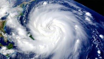
In October 2025, Hurricane Melissa devastated Jamaica with an estimated $2.4B in damages resulting in insured losses. One cat bond that was triggered gave investors pause, since triggering events are generally atypical. Let’s take a look at the storm and this specific cat bond.
Jamaica’s International Bank for Reconstruction and Development (IBRD) Capital-at-Risk (CAR) Jamaica 2024 $150M cat bond activated after Hurricane Melissa achieved certain parametric triggers, like its barometric pressure and path of destruction. The bond was issued in 2024.
The payout for Jamaica’s cat bond caps out at $150M and this issue will incur a full payout. However, with the overall cat bond market AUM sitting at over $55B, the bond’s total impact on the cat bond market is extremely limited. Ratings agency Fitch echoed this sentiment, noting that they don’t expect to see an averse reaction in the insurance-linked securities market as a result. In fact, post-loss periods can create pockets of spread widening in the affected peril or region, followed by renewed issuance at attractive coupons, which can be favorable for new investors.
The last time a hurricane triggered a full cat bond payout was in 2022, after Hurricane Ian, and before this, there were payouts in the wake of Hurricane Ida in 2021. That said, on a percentage basis, full cat bond payouts remain extremely rare. Back to the specific example from Hurricane Melissa, the activated IBRD CAR 2024 cat bond experienced a 1-in-45 year event, which ultimately triggered these investor losses.
Should cat bond investors be concerned about more triggering events and full-payouts resulting in more frequent potential losses? Looking back further in this year, even after record-high insured losses from the California wildfires, and still considering the recent years of growing activities from weather-related perils, S&P Global Ratings lists the default rate from both rated and non-rated catastrophe bonds at just 2.3%.
To add more historical content, historical annual default rates were at their peak (just above 10%) in 2017. This was following hurricanes Harvey, Irma and Maria and in an unusual and unexpected year of elevated hurricane activity: the second most hurricanes in a single year, dating back to 1960.
Since disaster-related events are ultimately impossible to accurately predict, it’s important for cat bond investors to remember that the bonds themselves are structured to have built-in protections. Most cat bonds feature multiple triggering events, and each event has its own coverage limit to diversify the risk. Investors can also look to diversify their risk and exposures by owning investments that can own many unique cat bonds within a single investment vehicle and further alleviate the pressure of a single event triggering significant losses.
The people impacted by Hurricane Melissa experienced a devastating storm and face a long rebuilding process. For the cat bond market, the storm provided a real-world proof of their purpose: to provide rapid capital determined by clearly defined parameters when disaster strikes. The payout of this specific IBDR cat bond can be a constructive case study for the asset class: it underscores transparency of triggers, may lift yields for Caribbean wind risk, and could pull in fresh capital at improved pricing. While obvious concerns about climate-driven volatility continue, the momentum around cat bond issuance and index returns are still powerful signals of the resilience of the asset class.
Hurricane Melissa is ultimately a sober reminder that triggers do happen, albeit infrequently. As investors, we can use this example as a teachable moment that there is a benefit to accessing the market through diversified investment vehicles, focusing on owning bonds with transparent triggers, and using post-event windows as potentially advantageous entry points for additional investment.
Sources:
Brookmont Capital Management Internal Research
Artemis
Bloomberg
Insurance Journal
Weather.com
The National Weather Service